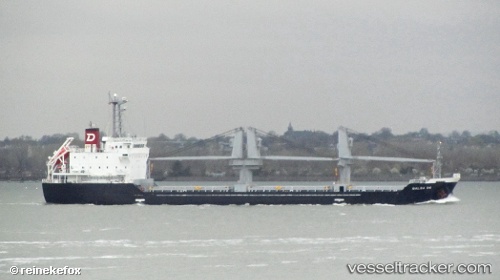
.

Port Punta de Maisi

Where is the Port?
PUNTA DE MAISI is located near the monitored sea lanes. The official UN/LOCODE of this port is CUUMA.

How many vessels are in Punta de Maisi port?
There are currently 2 vessels in port and 1 vessels recently departed.

Port map updates in near real-time from AIS snapshots and route transitions. Use the vessel-type filters and names toggle in the map control.

PA flag Balsa 86

Vessel type: General Cargo Ship | IMO: 9580273 | MMSI: MMSI: 372592000
Call sign: 3EYV6 | Dimensions: 106 m x 19 m
Current Status

Where is the vessel?

Balsa 86 is currently in 42 nm NW of Mathew Town, based on AIS data received about 14h ago.

Latest AIS update:

Current position: 21.23240° N, 74.35810° W (42 nm NW of Mathew Town)

Average speed (last 7 days): Loading…

Average speed (last 30 days): Loading…

Vessel profile: Balsa 86 is a General Cargo Ship with dimensions 106m x 19m.

This page combines live AIS, route history, probable destination signals, nearby traffic, and port activity for practical vessel monitoring.

The current position of vessel Balsa 86 is 21.23240 lat / -74.35810 lng. Updated: 2026-05-19 01:43:27 UTC
More recent position available: 13 min ago
Free positions are delayed by 14 hours.

We recommend registering. If you register, paid vessel access will be saved in your profile. Guest access works only through a personal link.

Nearest reference points:
  • 47 nm SW of Cockburn Harbour
  • 56 nm SW of Cockburn Harbour
  • 38 nm SW of Cockburn Harbour

Currently sailing under the flag of Panama PA flag

Balsa 86 built in 2011 year

Deadweight:
7720 t

Details:

Live Vessel Balsa 86 Analytics (details, animations, etc.)


Recent AIS points (UTC):
2026-05-18 22:22:07 UTC · 21.74583, -74.56604 · SOG 9.4 kn · COG 156°
2026-05-18 23:34:49 UTC · 21.56606, -74.49389 · SOG 9.9 kn · COG 156°
2026-05-19 01:43:27 UTC · 21.23240, -74.35810 · SOG 9.9 kn · COG 156°

Track of the vessel in the last 60 days


Most frequent incoming origins

No route destination distribution yet.

Most frequent outgoing destinations


You can see routes between ports on port-to-port analytics.


Link to the map:


Find another ship

Recent vessel arrivals at the port

Latest available transitions/port-call records (UTC). Total: 1
2025-09-03 18:03 UTC · US flagELSBETH III
IMO: 8983375, MMSI: 367017460 | Type:

Recent vessel departures from the port

Latest available transitions/port-call records (UTC). Total: 1
2025-09-03 18:03 UTC · US flagELSBETH III
IMO: 8983375, MMSI: 367017460 | Type:

Shipping companies (lines) whose ships most often called at the port Punta de Maisi:

No companies linked yet.

Port summary

Port congestion score

Loading congestion data…

Vessel type distribution for the last 3 months:

General Cargo Ship · 1 calls (100%)

Most frequent incoming origins

No route destination distribution yet.

Most frequent outgoing destinations


Vessels currently in port

Detected by latest AIS in the extended port area, latest 72 hours (deduplicated by vessel).

HN flagBELEN
Type: General Cargo Ship | IMO: 9196230, MMSI: 334976000 | AIS: 2026-05-19 10:06:44 UTC
PA flagBalsa-86
Type: General Cargo Ship | IMO: 9580273, MMSI: 372592000 | AIS: 2026-05-19 09:44:18 UTC

Expected arrivals

Forecast from transitions and inferred destination signals.


Port in news

Mentions from Topos news feed and spotlights.